image by Dov Gutterman | 2:3


Last modified: 2015-06-29 by andrew weeks
Keywords: efrata | efrat | mo'atza mekomit efrata | west bank occupied territories | judea and samaria |
Links: FOTW homepage |
search |
disclaimer and copyright |
write us |
mirrors
 image by Dov Gutterman | 2:3     |
See also:
Local Council Efrata (also known as Efrat) was established in
1983 and its name is taken from the bible (Derekh Efrata
[Efrata Way/Road] Genesis 38,19 - the name of the site
in which Our Mother Rachel was buried), and thats due to its
position between Bethlehem and Hebron (Judea and Samaria
District). Local Council since 1980 with 7.000 inh. (2003).
At <www.efrata.muni.il>
one can see the municipal emblem and here,
you can see photo of the
municipal flag.
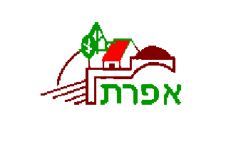
The emblem is symbolic and one can see trees,furrows and red-roof
house as well the Tomb of Rachel and inscription.
The flag is white and charged with the emblem.
Sources: <www.gushnews.co.il>.
Dov Gutterman, 9 April 2005
efrat.gif)
image from municipal website