 Shipmate Flagchart : http://www.flagchart.net
adopted 29 Feb 1984

Last modified: 2014-10-04 by andrew weeks
Keywords: skarsterlân |
Links: FOTW homepage |
search |
disclaimer and copyright |
write us |
mirrors
 Shipmate Flagchart : http://www.flagchart.net
adopted 29 Feb 1984
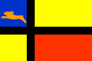
Only part of Doniawerstal went to Scharsterland, the rest went to Wymbritseradeel,
see :
Wymbritseradeel (Wymbritseradiel) [Incl.
Âldegea
(Oudega), Doniawestal (Doanjewerstal)and
Drylts
(IJlst)] for more details. [Ed]
 Shipmate Flagchart : http://www.flagchart.net
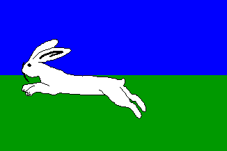
The flag of Haskerland flew only one year (1984- 3 Jan. 1985) when the
municipality was divided among Boarnsterhim, Skarsterlân and Lemsterlân.
(NB: The last three names are Frisian; before 1985 municipalities had only
official Dutch names. Several students were arrested after they replaced
the official roadsign of 'Franeker' with one with 'Frentsjer')
According to 'Encyclopedie van Friesland', 1958, the name Haskerland
derives from 'haske', 'heesc', an inferior species of grass.
The inhabitants preferred the meaning: 'hare'. Municipal seat; Joure
Jarig Bakker, 8 October 1999
 Shipmate Flagchart : http://www.flagchart.net