image by Ivan Sache, 22 March 2015

Last modified: 2015-04-04 by zoltán horváth
Keywords: piura | castilla | peru |
Links: FOTW homepage |
search |
disclaimer and copyright |
write us |
mirrors

image by Ivan Sache, 22 March 2015
The district municipality of Castilla (123,692 inhabitants in 2007; 66,223
ha) is located in the Piura province. The municipality is made of the town of
Castilla and of the rural settlements of Miraflores, Río Seco, Chapairá, Terela,
El Papayo, San Vicente, La Obrilla, San Rafael and Cruz de Caña. The neighbour
towns of Castilla and Piura are separated by river Piura.
Castilla was originally known as Tacalá, part of the Piura district. The Tacalá
district was established by Transitory Law, promulgated on 2 January 1857 by
President Ramón Castilla, and renamed Castilla in 1860.
The Castilla district, part of the Piura province, was established by Regional
Law No. 208 of 30 March 1861. Re-incorporated to the Piura district by Law No.
723 of 10 August 1908, the Castilla district was re-established by Regional Law
No. 268 of 13 August 1920.
Source:
http://www.municastilla.gob.pe/ - Municipal website
Ivan Sache, 22 March 2015
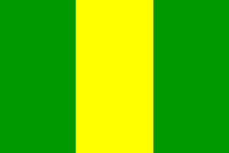
The flag of Castilla is vertically divided green-yellow-green. Green and
yellow symbolize agriculture and progress.
Source:
http://www.municastilla.gob.pe/bandera.html - Municipal website
Ivan Sache, 22 March 2015