This page is part of © FOTW Flags Of The World website
Cranendonck (The Netherlands)
Noord-Brabant province
Last modified: 2011-06-04 by andrew weeks
Keywords: cranendonck | crane |
Links: FOTW homepage |
search |
disclaimer and copyright |
write us |
mirrors
 Shipmate Flagchart : http://www.flagchart.net
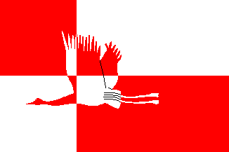
Adopted 18 Nov 1997
See also:
Cranendonck municipality
Number of inhabitants (1 Jan 2003): 20.318; area: 78,14 km². Settlements:
Budel (seat), Budel-Dorplein, Budel-Schoot, Gastel, Kernen, Maarheeze,
Soerendonk.
Cranendonck is a merger (1 Jan 1997) of the former municipalities of
Budel and Maarheeze, situated
in the southeast of the North Brabant province (about 35 Km south - southeast
of Eindhoven), to the east is the municipality of Weert
in the Limburg province, and to the west is the
Belgium municipality of Hamont - Achel.
Cranendonck Coat of Arms
cd.jpg) image from the Cranendonck municipal
website.
image from the Cranendonck municipal
website.
Granted 23 Feb 1998
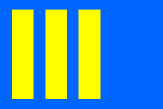
Budel [former municipality]
 Shipmate Flagchart : http://www.flagchart.net
This flag was approved by the municipal council on 21 October 1965.
Budel Coat of Arms
See International Civic Arms : http://www.ngw.nl/heraldrywiki/index.php?title=Budel
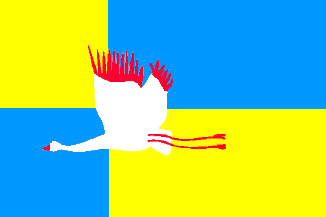
Maarheeze [former municipality]
 Shipmate Flagchart : http://www.flagchart.net
This flag was approved by the municipal council on 16 August 1973.
The former municipality of Maarheeze was a merger of 4 towns, Maarheeze,
Gastel, Soerendonk and Sterksel (all except Sterksel are part of the new
Cranendonck municipality - Sterksel went to the municipality of Heeze-Leende).
Maarheeze Coat of Arms
See International Civic Arms : http://www.ngw.nl/heraldrywiki/index.php?title=Maarheeze
 Shipmate Flagchart : http://www.flagchart.net

 Shipmate Flagchart : http://www.flagchart.net
cd.jpg) image from the Cranendonck municipal
website.
image from the Cranendonck municipal
website.
 Shipmate Flagchart : http://www.flagchart.net
 Shipmate Flagchart : http://www.flagchart.net